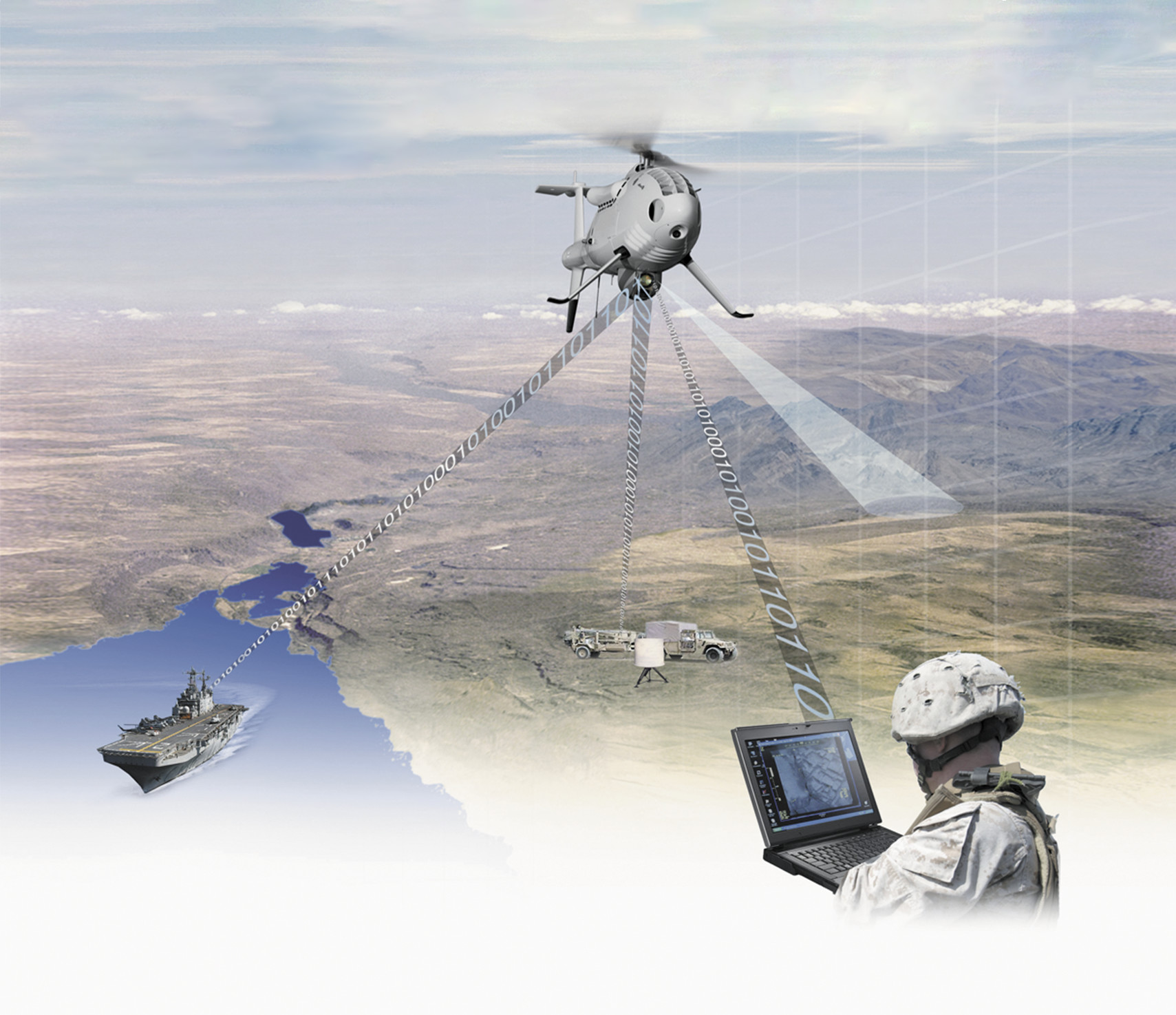
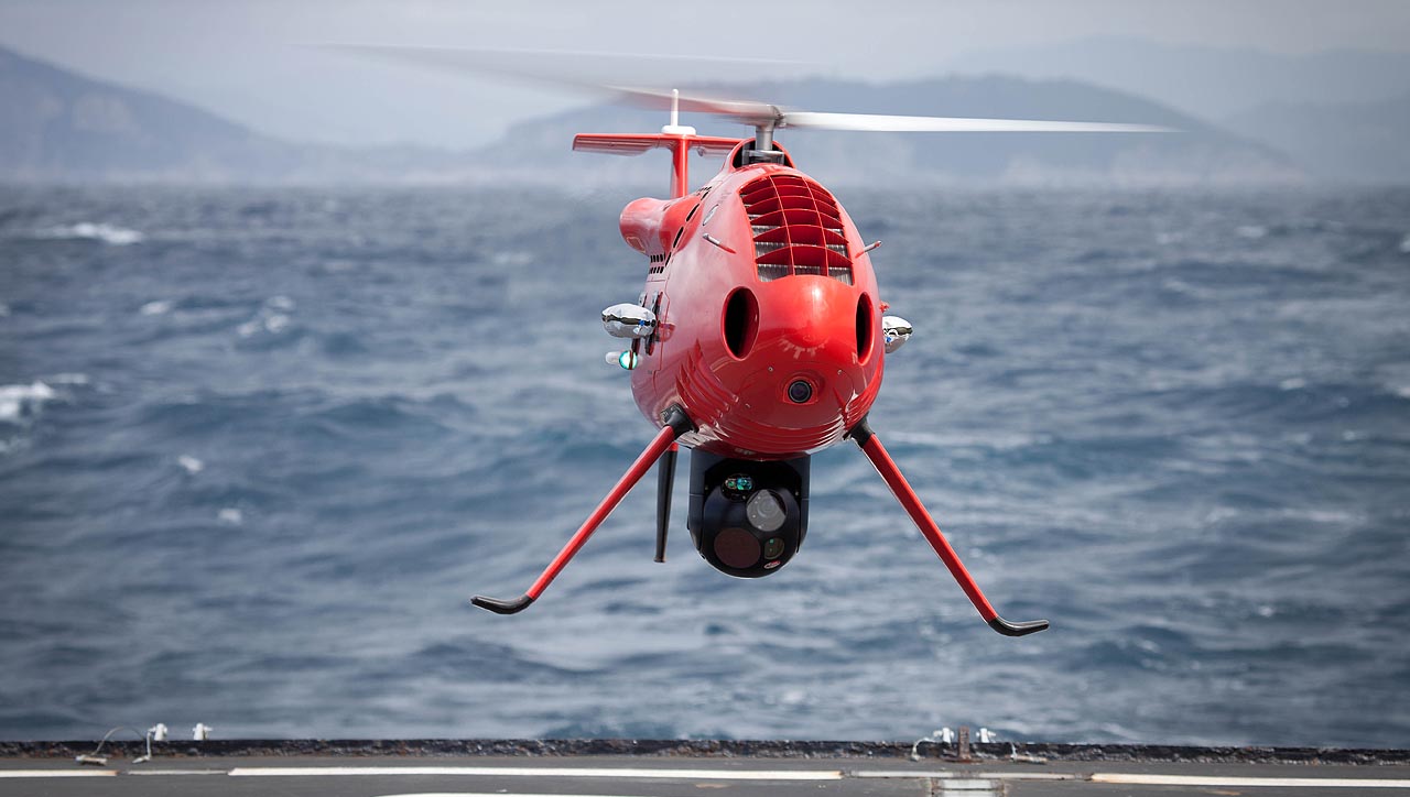
In addition to sensor imagery, the S-100 provides real-time video, enabling the crew to see conflicting traffic or any obstacles that may be present.
In addition to sensor imagery, the S-100 provides real-time video, enabling the crew to see conflicting traffic or any obstacles that may be present.
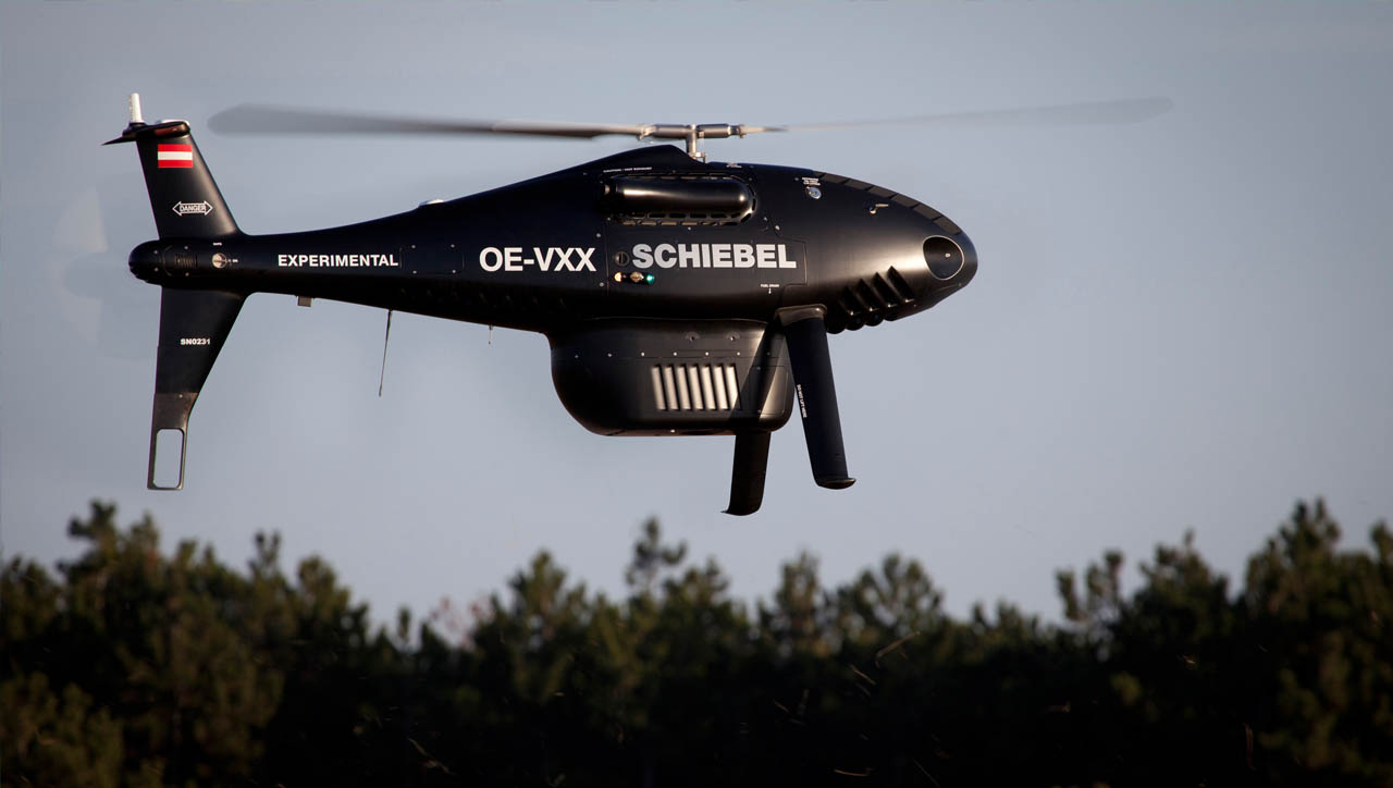
• Fully autonomous system from takeoff to landing
• Accurate navigation using dual GPS and GLONASS receivers
• Reliability through the use of redundant systems, i.e. inertial measurement units
• Fully autonomous system from takeoff to landing
• Accurate navigation using dual GPS and GLONASS receivers
• Reliability through the use of redundant systems, i.e. inertial measurement units
Specifications
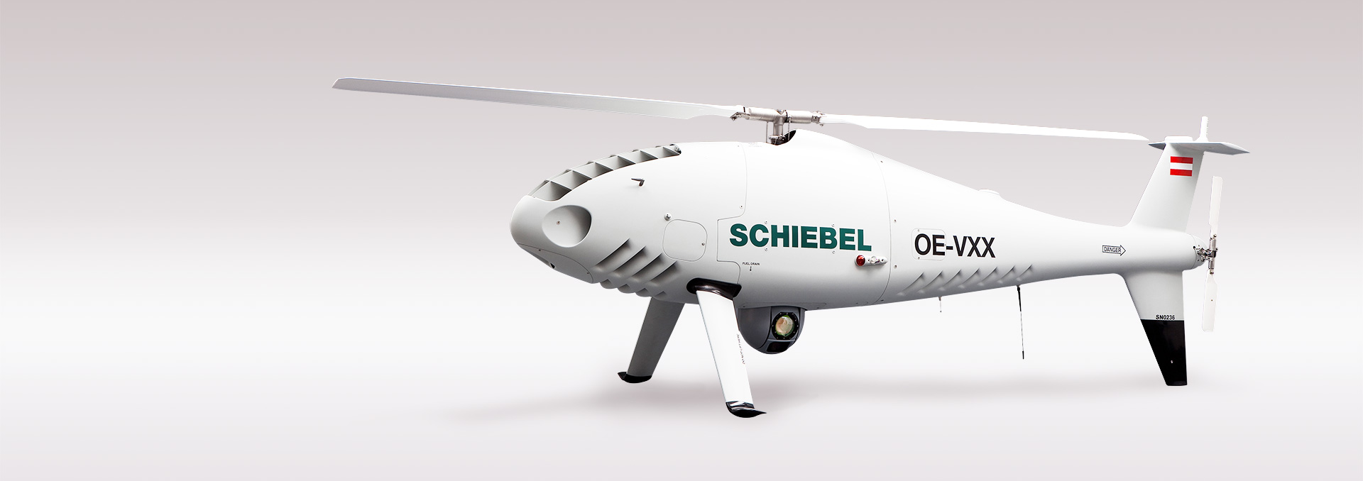
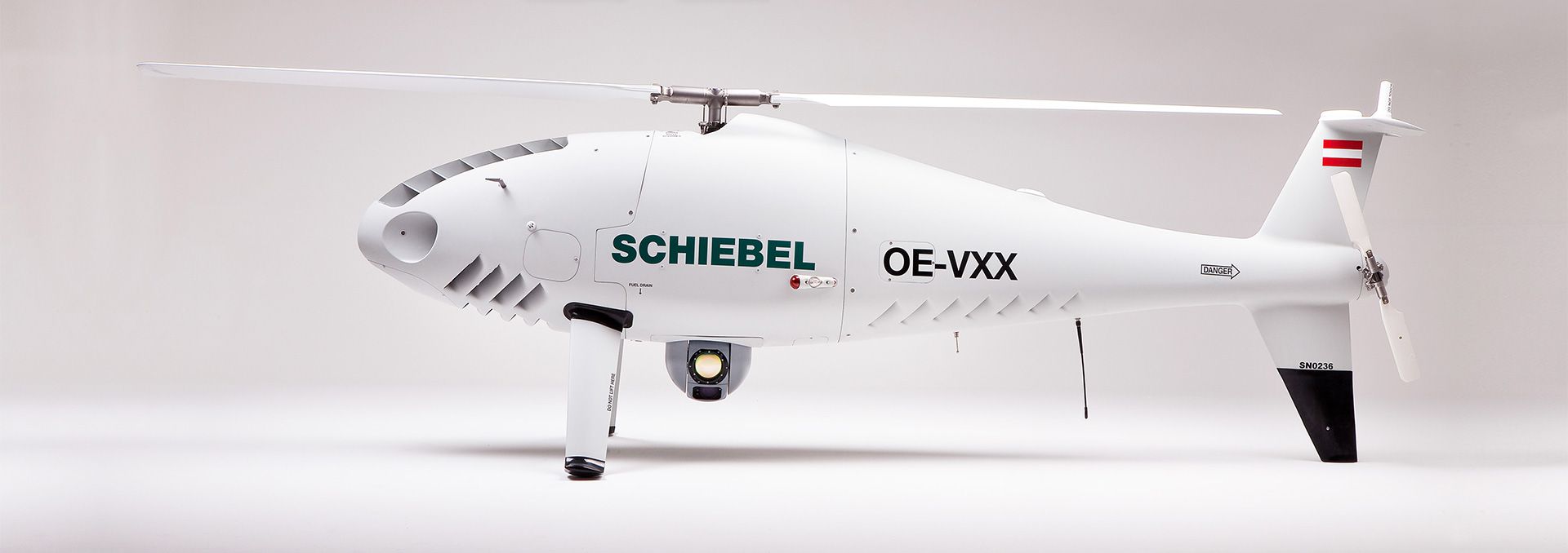
The CAMCOPTER® S-100 offers proven, reliable performance, long operational ranges, accurate navigation and high-data-rate communications capabilities.
| Dash speed | 100 kn (185 km/h) IAS |
| Loiter speed | 55 kn IAS (102 km/h) for maximum endurance |
| Endurance | >6 h with 34 kg (75 lbs) payload plus optional external fuel tank extending endurance to >10 h |
| Service ceiling | 18000 ft in ISA conditions @ reduced GW |
| Airframe loading | +3.5 g to -1 g rated |
| Operating temperature | -40°C to +55°C (-40°F to +131°F) |
| Wind (takeoff and landing) | Up to 25 kn (46 km/h) |


| Main rotor diameter | 3400 mm (133.9”) |
| Total length | 3110 mm (122”) |
| Total height | 1120 mm (44”) |
| MTO weight | 200 kg (440 lbs) |
| Typical empty weight | 114 kg (251 lbs) |
| Payload capacity | 50 kg (110 lbs) |
| Fuel (internal tanks) | 57 l (15.0 gal) AVGAS 100LL, JP-5 (NATO F-44), Jet A-1 (NATO F-35) |
| Payload electrical power | 1000 W |
| Data link range | Up to 200 km (108 nm) available |


NOSE PAYLOAD BAY
Max. payload weight 10 kg (22 lbs)
NOSE PAYLOAD BAY
Max. payload weight 10 kg (22 lbs)
SIDE PAYLOADS
Max. payload weight 10kg (22 lbs) on each side
SIDE PAYLOADS
Max. payload weight 10kg (22 lbs) on each side
MAIN PAYLOAD BAY
Max. payload weight 50 kg (110 lbs)
MAIN PAYLOAD BAY
Max. payload weight 50 kg (110 lbs)
AUXILIARY PAYLOAD BAY
Max. payload weight 10 kg (22 lbs)
AUXILIARY PAYLOAD BAY
Max. payload weight 10 kg (22 lbs)
Payload
The CAMCOPTER® S-100 features platform and payload growth capabilities – with two payload bays, an auxiliary electronics bay, as well as two side payload hard points and the ability to carry underslung loads. The maximum payload weight is 50 kg (110 lbs).
The CAMCOPTER® S-100 is able to carry multiple sensors, enabling customers to gather images with an EO/IR camera, detect and identify electronic signatures with ESM systems and use SAR radar simultaneously in real-time with only one system.
Electro-Optical/Infrared (EO/IR) gimbals provide advanced wide-area situational awareness and intelligence gathering through collection, identification, categorization and geo-location of static and moving objects of interest. It provides real-time, high-definition video to commanders and decision makers for uninterrupted surveillance of borders, urban areas, activity and events both by day and night.


Synthetic Aperture Radar (SAR) is a radar system that uses the flight path of the platform to simulate an extremely large antenna or aperture electronically and generates high-resolution remote sensing imagery. SAR is used to create images of an object, such as a landscape. These images can be 2D or 3D representations of the object. High-resolution SAR provides true, all-weather ground mapping and surveillance imaging, as well as Ground Moving Target Indication (GMTI).


Laser Imaging Detection and Ranging (LIDAR) is a remote sensing technology that measures distance by illuminating a target with laser and analyzing the reflected light. LIDAR for 3D geographic survey systems provides geologists and mapping professionals with the ability to examine both natural and man-made environments with more accuracy, precision and flexibility, and to produce highly accurate maps and digital elevation models for use in geographic information systems.


Signals intelligence (SIGINT) is intelligence gathering by interception of signals, whether it be communication between people (communications intelligence, abbreviated to COMINT) or electronic signals not directly used in communication.
It provides wide-area situational awareness and intelligence gathering by means of collection, identification, categorization and geo-location of complex emitters.
Airborne COMINT significantly improves the efficiency of monitoring and intelligence missions.


Hyperspectral imaging may be used to collect and process information from across the electromagnetic spectrum. Hyperspectral sensors are ideal to map large geographic areas quickly and accurately, showing mineral resources development on the surface of the earth. The maps may subsequently be used to assess the relative abundance of minerals and their importance in the local geological context.


The S-100 can be fitted with a wide variety of payloads, tailored to meet specific requirements: AIS, integrated spotlights and loudspeakers are available.


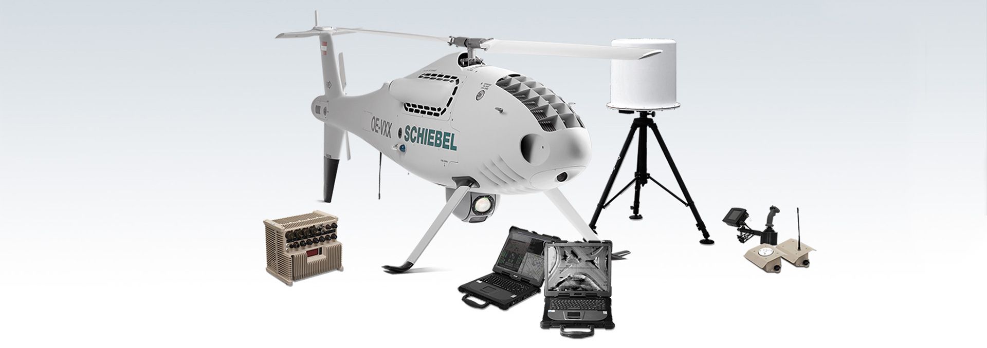
The control workstation displays the position of the UAV as well as status information in real time.
The control workstation displays the position of the UAV as well as status information in real time.
The CUBE acts as a central hub between the UAV (via the datalink), all ground components and higher-level networks.
The CUBE acts as a central hub between the UAV (via the datalink), all ground components and higher-level networks.
The payload control workstation allows the operator to control the payload while also having access to video viewing, recording and frame capture.
The payload control workstation allows the operator to control the payload while also having access to video viewing, recording and frame capture.
Its encrypted data link provides an exceptional line-of-site range with antenna options available out to 200 km.
Its encrypted data link provides an exceptional line-of-site range with antenna options available out to 200 km.
Global Positioning Systems (GPS) ensure high-accuracy navigation and stability, including optional anti-jamming features.
Global Positioning Systems (GPS) ensure high-accuracy navigation and stability, including optional anti-jamming features.
Dual-redundant Inertial Navigation Systems (INS)
Dual-redundant Inertial Navigation Systems (INS)
Operational Options
The S-100 has been widely deployed and used around the globe in a variety of environments, from the cold of the Artic to the heat of deserts, aided by its minimal logistics footprint and its ability to be simply and quickly deployed.
Schiebel recognized that effective and efficient operations require a UAS that presents the smallest possible resource and, importantly, no longer relies on other systems or assets to cue their intelligence collection process.
- Control station space: 6060 mm x 2440 mm (239" x 96″)
- Quick setup time: 3 h
- Operated by 2 persons
- System can be transported / operated from a 20′ container

- Unlimited flexibility
- Simple integration into vehicles
- Flexible integration into command and control systems
- Operation from urban and austere sites

- Detection, tracking and identification of maritime-based objects and events
- 360-degree coverage
- Accurate geo-location
- Two-man operation and small equipment and logistics footprint
- Proven on a variety of ships
- Simple ship integration, no requirement for specialized infrastructure
- NATO-standard harpoon option
Operation possible in:
- Harsh environmental conditions
- High sea states
- Strong cross-deck winds

- The S-100 UAS as part of your system
- Integration with customer networks
- Robust, secure and timely, anywhere and anytime for anyone on anything